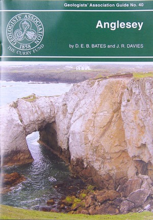
Anglesey
Geologists’ Association Guide No 40
By D E B Bates and J R Davies

This is another of the GA’s short guides, being only 31 pages long. Therefore, it is perfect to fit in a coat pocket to refer to during a walk. And Anglesey is a favourite holiday destination , so the combination of fossils, geology and scenery make for a winning combination.
In fact, Anglesey contains a fascinating variety of rock types and geological structures, best exposed in a magnificent coastline. The bedrock geology of Anglesey comprises a complex collage of igneous, sedimentary and metamorphic rocks that were formed between 300 and 650 million years ago. In fact, taken together, the geological record that can be inspected on the isand also provides evidence of most of the major plate tectonic episodes responsible for assembling southern Britain.
In this way, hard rock and structural geology interests are catered for in Precambrian and Ordovician areas, fossils in the Ordovician and Carboniferous and sedimentology in all the systems.
The ten itineraries are set out in roughly stratigraphical order, but each itinerary covers a particular area. The guide provides an indication of the approximate length of each itinerary and their dependence on tides.
The locations consist of:
- Holy Island.
- Central West Anglesey.
- Southern Anglesey.
- Carmel Head.
- Cemaes Bay to Porth Wren.
- Dulas Bay to Point Lyas
- The Ordovician rock of Central Anglesey.
- Parys Mountain.
- The Old Red Sandstone.
- Lower Carboniferous of the coast from Lligwy Bay to Red Wharf Bay.
As always in GA guides, these are all great areas to visit on holiday, so I recommend taking this book with you if you are going to be nearby. This guide can be bought at the Geologists’ Association website.
Anglesey, Guide No 40, by D E B Bates and J R Davies, The Geologists’ Association, London (1981), 31 pages (paperback), ISBN: 9780900717659