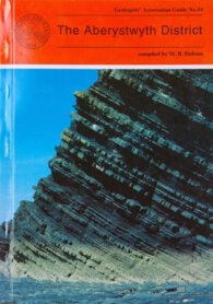
Geologists’ Association Guide No 54
Compiled by Max R Dobson

This GA guide was first published in 1995 and is a great example of the sort of guide that the association still produces – coverage of small(ish), but important areas, where the geology is both fascinating and important. This one contains general descriptions of the geology and geomorphology of this part of west Wales, with 19 separate itineraries, written by 11 experts in their fields.
Why produce a geology guide on this part of the Principality, around the university town of Aberystwyth?
Well, the area has been recognised for over 100 years as possessing fascinating geology and it is the cradle of Welsh Basin studies because the Aberystwyth Grits and Borth Mudstones (both Silurian) are magnificently exposed in accessible cliffs along the coastline of Cardigan Bay. It is also world-famous for its classic examples of turbidity current deposition. There are also important fossiliferous sites near Plynlimon and the region is known for the variety of its glacial landforms and modern sedimentary environments.
Of the 19 routes, the first eight deal with the variations in the turbidite fan succession between New Quay in the south and Harp Rock in the north. The other 11 cover the Dovey Estuary, the Quaternary and solid geology of Cardigan Bay, and the Plynlimon area. And there is also a useful (and, indeed, essential) glossary.
Inevitably, the diagrams and photos in this guide are black and white, but that isn’t really a problem. Therefore, if you can get hold of this guide, it is well worth doing so if you are visiting the area.
This guide is available directly from the Geologists’ Association‘s website.
The Aberystwyth District, Guide No 54, Guide No 54, compiled by M R Dobson, The Geologists’ Association, London (1995), 109 pages (paperback), ISBN: 0900717777


