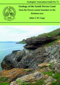
The is a second edition of Prof John Cope’s excellent geological guide to the Dorset coast for the Geologists’ Association. It is slightly shorter than the first edition, with some minor corrections and some of the figures revised, together with new photographs. It also now includes the huge quantity of data amassed over last few decades during the hydrocarbon exploration work in the county.

This is one of the oldest of the GA’s guides and is currently in its third edition (the first having been published in 1957 and the second in 1972). Although there have been changes in classification and so on, the general exposures are largely as good as they used to be – or they were the last time I went!

I have reviewed some excellent previous guides in this series (Iceland: Classic Geology in Europe 3), but this one is closer to home and covers an area that I have fond memories of from my Munro-bagging days. This is more a companion guide for those walking in the Highlands, especially those on geological field trips.

Recently, I have finished the Great Silurian Controversy, a magnificent book about the nineteenth century arguments over the age of the lower Palaeozoic greywackes/sediments of Devon, and the creation of the concept of the Devonian. And reading The Lewisian: Britain’s oldest rocks by Graham Park, it occurs to me that this should perhaps be called, The Great Lewisian Controversy. It shares the same historical and scientific intentions, and the same grand sweep of scientific history, this time from the early twentieth century – namely, the exploration over decades of the geology of the Lewisian of northwest Scotland.

I remember reading and enjoying this book when the first edition came out many years ago. I am also a keen hillwalker and have stood on top of many of the Scottish mountains referred to in the text. In fact, I particularly enjoyed climbing Ben More on the island of Mull, which I remember reading was the last volcano in northwest Europe.

For anyone like me who finds the immensity of geological time (‘deep time’) both fascinating and fundamentally difficult – both emotionally and intellectually – this is a great book. Paul Lyle has written it for environmentalists and policy makers to help them explain their concerns and decisions more clearly in the context of geological time, but these are not the only people who should read it.

Howgill Fells

This little guide contains excursion guides explaining and exploring the relationship in the UK between hillslope gully erosion and the response by stream and valley systems within the Howgill Fells of Cumbria. The author’s choice of this area rests on the fact that it is one of the most active landscapes in Britain from the point of view of erosion, with the steep slopes of the headwater valleys, which are riddled by networks of erosional gullies that have been active in the relatively recent past.

As a former ‘Munro bagger’ and now keen geologist, this book combines two of my favourite pastimes. While the body is not quite so willing as before, the ability to read about the geology of some of my favourite Scottish walks is an absolute pleasure.

Almeria is a province in southeast Spain, situated in the furthest southeast part of the Iberian Peninsula. And it is a classic area for southern European and Mediterranean Neogene and Quaternary geology. In fact, it is not far north of the southern boundary of the European tectonic plate and, as a result, has been profoundly affected by the interaction of this and the African plate.

Red Coast Revealed

The Jurassic Coast Trust has certainly producing some good books. As is well known, in recognition of its wonderful geology, the coast between Orcombe Rocks in southeast Devon and Old Harry Rocks in south Dorset was granted World Heritage status in December 2001. In this respect, these two guides cover the western and the eastern thirds of this remarkable coastline.

This is another of GA’s guides, this time to the geology and geomorphology of the popular holiday destination of the Castleton Area in Derbyshire. I love this area and have visited there both for the geology and the beautiful scenery.

The island of Cyprus is a truly classic area of geology in Europe. Perhaps nowhere else on Earth does so small an area provide such an excellent illustration of the dynamics of Earth processes through abundant exposures of spectacular and diverse geology.

A great number of geology books have been published in recent years about Scottish geology and I have had the privilege of reviewing a number of them. This plethora of publications is not surprising. As this book points out, in the six hundred miles between the Shetland island of Unst in the north to the Mull of Galloway in the south are some of the most interesting, varied and beautiful landscapes in Europe, if not the world.

If Yorkshire really is ‘God’s Own County’, then clearly the Almighty is an extremely enthusiastic geologist. Just how lucky is the Yorkshire man who, on the same day, can see some of the best and most varied geology in the world, set out in glorious coastal and mountain scenery, collect superb fossils and minerals, and still be back in the pub in time for some of the best real ale in the UK? That is, Yorkshire is a geological gem that needs a good geological guide.

This is an interesting book for those of us who are curious about the complex origins, variety and geological history of the continent of Europe. In particular, it covers and explains the background to its distinct regions and landscapes – from the flat plains of Northern Europe to the Alps and related mountains of the south.

I love geomorphology. I suspect many people are discouraged by its scientific name, but all it means is the study of the earth’s landforms and the processes that create the landscapes we see today. That is, why this coastline looks different from that, why that mountain is a funny shape, why Africa seems to fit into South America like a jigsaw, and so on and so forth.

This is a third, revised edition of a very successful, introductory-level geology guide. In it, the author has taken the opportunity to revise and update the text, and to substitute improved illustrations for some of the old ones.

Walking the East Jurassic Coast

In recent years, the Jurassic Coast Trust really has produced some great books and I have had the privilege of reviewing quite a number of them. These two companion books are intended as walking guides to the World Heritage Site – the so-called ‘Jurassic Coast’ – and the first covers the western limb from Orcombe Point to the Fleet, while the second deals with the eastern part, from Portland to Studland.

This is a brief guide explaining how the reader may collect meaningful data at outcrop level and make provisional identifications of common lithologies. It is not intended as a comprehensive field geology textbook and assumes that readers have already studied geological theory (and, as such, is probably most useful of the undergraduate, but could be interesting for anyone interested in geology).

The Geologists’ Association has produced yet another great guide, this time on the geology of Wales. However, this is a slightly different beast from most of their other publications. As is always the case with this excellent series of guides, the book describes the geology of different sites capable of being visited. However, this time, the conceit is that visiting the locations is assumed to be by car.

Back in 1994, Scottish Natural Heritage, together with the BGS, published a guidebook entitled Cairngorms: A landscape fashioned by geology. With the publication of Argyll and the Islands: A landscape fashioned by geology, it has now extended this excellent series to 20 such guides.