Jon Trevelyan (UK)

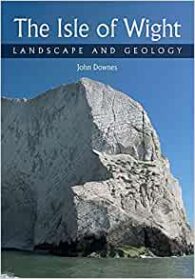
This is another guide in the excellent “Landscape and Geology” series of local geological guides published by The Crowood Press. And this is as good as the others. Admittedly, it has a wonderful subject matter, because the Isle of Wight is a geological gem with its 110km long coastline displaying a range of rocks dating from Lower Cretaceous to Oligocene age. I know from personal experience that many of its sands and clays contain collectable fossil bivalves and gastropods, and its famous dinosaur footprints attract attention from both geologists and tourists, with always the possibility of finding a bone or two.
However, as the book explains, the beauty of the island, in terms of its outstanding scenery, is the result of its differing strata, former tect0nic movements, and erosion by the sea and rivers. A great example of this is the monoclinal fold running east-west across the centre of the island, which gives rise to the ridge of chalk downland ending in the cliffs of Culver in the east and the world-famous Needles in the west.
In contrast, the softer rocks produce low, slumped cliffs, which are often cut by steep-sided chines or, alternatively, on the north coast, branching estuaries and salt marsh creeks. (A ‘chine’ is a steep sided river valley, where the river flows through coastal cliffs to the sea. The word originates from the Saxon ‘Cinan’ meaning a gap or yawn.)
As always with this series of books, this one is beautifully illustrated, with over 120 colour illustrations. And, like the others, it discusses the geological processes that created the island’s distinctive landscape in a simple (but not patronising) language that will be attractive to a wide range of readers interested in geology.
In this way, it provides a field guide to the identification of rocks and fossils, and includes details of 20 itineraries to follow that will allow visitors to discover the island’s geology, with explanations of the geology and the fossils that may be discovered on the way. These trips include all the usual suspects as far as the coastal sites are concerned, but also include interesting walks inland, including along the River Yar and over Tennyson Down.
A full list the itineraries is as follows:
- Itinerary 1: Shippard’s Chine to Chilton Chine
- Itinerary 2: Chilton Chine to Shepherd’s Chine
- Itinerary 3: Shepherd’s Chine to Rocken End
- Itinerary 4: Yaverland to Culver Cliff
- Itinerary 5: Sandown Pier to Monk’s Bay via Knock Cliff
- Itinerary 6: Compton Bay
- Itinerary 7: Freshwater Bay
- Itinerary 8: Freshwater Bay to the Needles over Tennyson Down
- Itinerary 9: Alum Bay
- Itinerary 10: Whitecliff Bay and Culver Down
- Itinerary 11: Hampstead Cliff
- Itinerary 12: Colwell Bay to Sconce Point
- Itinerary 13: Along the Chalk Downs from Brading to Freshwater Bay
- Itinerary 14: A walk on the Southern Downland
- Itinerary 15: The Yar River Trail, Niton to Bembridge Harbour
- Itinerary 16: A walk from Blackgang to Newport
- Itinerary 17: Windy Corner (below Gore Cliff) to St Lawrence via the Undercliff
- Itinerary 18: Alum Bay to Totland Bay over Headen Hill
- Itinerary 19: Nettlestone Point to Bembridge Harbour and the Foreland
- Itinerary 20: A Heritage Coast – Newton Bay to Gurnard
John Downes has taught Geography and Geology to college students for many years, and has also tutored Earth Science students for The Open University and geology groups within the University of the Third Age. He lives in rural Somerset, where he continues to write on geological themes.
Other books in this series include The Peak District: Landscape and Geology and The Lake District: Landscape and Geology.
Isle of Wight: Landscape and Geology by John Downes, The Crowood Press Ltd (2021), 112 pages (paperback), ISBN: 978-1785008924.


