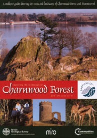
A Walker’s Guide Showing the Rocks and Landscape of Charnwood Forest and Mountsorrel

This publication from the British Geological Survey follows the success of its earlier publication, Exploring the Landscape of Assynt.
The area is famous for its extremely ancient volcanic rocks (600Ma) – mainly Precambrian igneous diorites. These formed from molten lava deep within sedimentary rocks, cooling slowly to produce hard, blocky rock. It is also the site of the first-ever recorded discovery of Charnia masoni, one of the earliest-known large, complex fossilised species, dating back to the Ediacaran Period.
Exploring the Landscape of Charnwood Forest and Mount Sorrel consists of a special, plastic-covered pack, containing both an explanatory booklet and a new 1 : 25,000 scale geological map of the Charnwood Forest and Mountsorrel area.
The detailed map contains various cross-sections. These include a diagram of a typical pre-Cambrian Charnwood volcano and examples of various geological formations present in the area, together with photographs and charts. This resource alone provides a wealth of information.
The booklet is over 50 pages long and contains many illustrations and photographs in full colour. In a similar format to the Assynt publication, it includes geological walks in the area explaining: in a step-by-step way, the geological features along each route, and describes the rocks, fossils and minerals that can be found. The booklet also provides general explanations of the geology covered in the pack and contains a glossary of the terms used.
Geological trails and walks have become extremely popular in recent years and this is one of the best and clearest publications of this sort available. Highly recommended.
Exploring the Landscape of Charnwood Forest, British Geological Survey (2007), 52 pages (paperback), ISBN: 978-08-52725-70-2


